Terrain modeling can be approached through various frameworks. Two common methods are Triangulated Irregular Networks (TINs) and Discrete Global Grid Systems (DGGS). Each has distinct geometric structures, elevation representations, scale properties, and storage formats.
Geometry
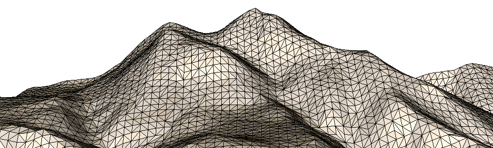
TINs use irregularly spaced triangles to model surfaces. These triangles adapt to terrain complexity, offering detailed representations where needed. DGGS, in contrast, uses regular, equal-area cells that cover the Earth’s surface. These cells can take the form of triangles, quadrilaterals, or hexagons depending on the grid system, offering a consistent geometric structure that simplifies spatial analysis.
Representation of Elevation
In a TIN, elevation values are assigned to the vertices of triangles. These values define the triangular faces that approximate the terrain surface. In a DGGS, elevation is typically represented at the centroid of each cell, where the value serves as an aggregate or sample for the cell’s coverage area. This difference influences how elevation is interpreted and analyzed across a surface.
Spatial Scale
TINs usually operate at a single, fixed resolution, tailored to a specific application or data source. DGGS offers built-in support for multiple resolutions through its hierarchical structure. Elevation data can be generated or aggregated at different levels of detail as needed, making DGGS well suited for multi-scale analysis and modeling.
Data Storage and Complexity
TINs are vector-based and require detailed topological information. Storing a TIN involves managing point coordinates, elevation values, edge connections, and triangle topology. DGGS storage is simpler by comparison. Each cell has a unique address and associated data values such as elevation, slope, or land cover. This makes DGGS more efficient for large-scale terrain data storage and transmission.
TINs provide local precision with adaptive geometry. DGGS provides global consistency with scalable resolution. Choosing the right model depends on the goals of the terrain analysis and the scope of the application.