Traditional Geographic Information Systems (GIS) and Discrete Global Grid Systems (DGGS) offer distinct approaches to spatial data modeling. While both aim to represent and analyze geographic phenomena, they are built on fundamentally different concepts.
Thematic Layers vs. Congruent Geography
A well-known analogy describes GIS as slicing the world into thematic layers, while DGGS brings that information back together into a unified spatial structure. In traditional GIS, layers are used to model different aspects of the real world, such as elevation, land use, or infrastructure. This is effective when analyzing a single theme, but less efficient when querying multiple layers at the same geographic location.
Vector layers require geometry-specific operations to extract or intersect data. Raster layers often differ in resolution, alignment, and origin, requiring preprocessing before analysis. These inconsistencies make integrated spatial analysis more complex.
DGGS, on the other hand, defines a set of fixed, equal-area cells at each resolution level. Each cell serves as a consistent spatial reference that supports straightforward data alignment. This structure forms a multi-resolution, congruent geography that simplifies integration and continuous monitoring at any location.
Single Resolution vs. Multiple Granularities
Most traditional GIS analyses are performed at a single resolution, often without a clearly defined or consistent notion of spatial scale. While multi-scale studies exist, they often rely on manually created datasets or imprecise assumptions about resolution.
DGGS is inherently multi-resolution. It features a hierarchical grid structure where each level corresponds to a specific, quantifiable resolution. Each cell can be subdivided into smaller units using a consistent refinement ratio. This systematic structure enables native support for multi-scale modeling, observation, and visualization. Analysts can zoom in or out across scales while maintaining spatial consistency and integrity.
Continuous Space vs. Discrete Grid
Traditional GIS represents space as continuous, using floating-point coordinates to locate objects or features. This introduces issues related to numerical precision, ambiguous neighborhood definitions, and challenges in handling topological relationships.
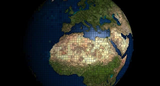
DGGS operates in a fully discrete space. The Earth is partitioned into a finite set of non-overlapping, gap-free cells at each resolution level. Each cell is computationally independent and serves as a standardized spatial unit. Unlike other grid systems such as latitude–longitude or Google’s S2, DGGS offers uniform spatial resolution, consistent global coverage, and scale-aware indexing that supports both local and global analysis.
Flattened Models vs. True 3D Representation
Traditional GIS models are typically projected into a 2D Cartesian coordinate system, even when displayed in 3D visualization environments. This flattening leads to inconsistencies in area, shape, and distance across latitudes, resulting in spatial distortion.
DGGS provides a more faithful three-dimensional representation of Earth. It accounts for Earth’s curvature in its design, ensuring that spatial resolution remains consistent across latitudes. The hierarchical structure maintains approximately equal-area cells across all regions of the globe, making DGGS well suited for global-scale modeling, particularly in domains where spatial accuracy and comparability are critical.
While traditional GIS tools remain essential for many applications, DGGS introduces a more consistent, scalable, and globally integrated approach to spatial data modeling. Understanding these conceptual differences is key to unlocking the potential of DGGS in next-generation geospatial science.